
Kaunos Ancient City
10 min boat ride from Dalyan
This archaeological site features Lycian rock tombs and a Roman theater overlooking the Dalyan River. It is accessible via small shuttle boats from the Dalyan harbor.

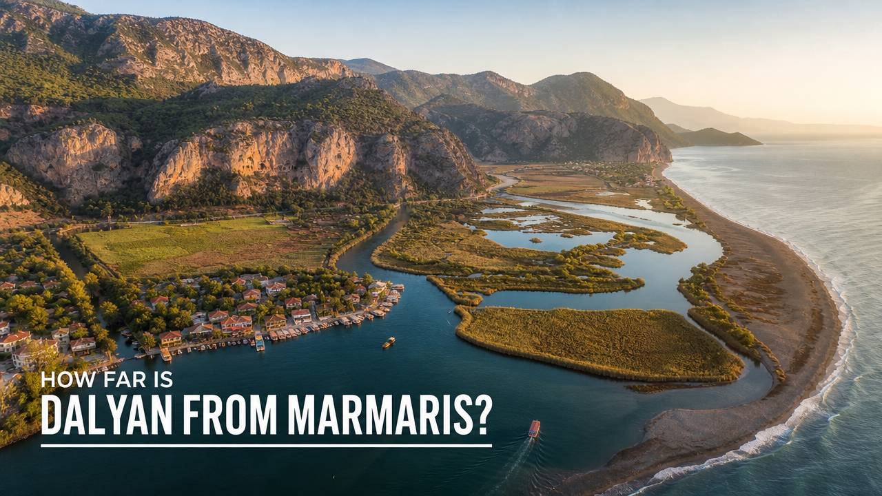
Dalyan sits 25 kilometers northeast of Marmaris as the crow flies, but the journey between the two involves a choice of routes that shape your travel time. The direct coastal road and the inland highway offer different landscapes and traffic patterns. This guide breaks down the distance, route options, and practical timing considerations for travelers planning the connection between Marmaris and Dalyan.
Quick answer
How far is Dalyan from Marmaris? The direct distance is approximately 25 kilometers, but road routes extend to 30-35 kilometers depending on your chosen path. The coastal D400 highway via Içmeler covers roughly 32 kilometers and takes 45-55 minutes in normal traffic. Morning departures between 08:00 and 10:00 avoid peak midday summer heat on the exposed D400 highway, particularly important for non-air-conditioned vehicles or motorcycles.
The Dalyan-Marmaris corridor spans one of the Muğla Province's most traversed short-haul routes, yet the actual distance surprises first-time visitors who expect a longer separation between the bustling resort town and the tranquil river settlement. The 25-kilometer straight-line measurement translates to a 30-35 kilometer drive depending on whether you take the coast-hugging D400 or cut inland through Ortaca. The D400 coastal route via Içmeler follows the Mediterranean shoreline for much of its length, offering intermittent sea views but carrying heavier seasonal traffic between June and September. This road connects Marmaris center to Dalyan's northern access point in approximately 50 minutes under standard conditions. The alternative inland route through Ortaca adds negligible distance but trades coastal scenery for a straighter, often faster path through agricultural valleys and pine-covered hillsides. Both routes converge near Ortaca, the administrative district that governs Dalyan, before the final approach along the reeds and mud flats of the Dalyan River delta. Ferry services between Marmaris and Dalyan do not operate as scheduled public routes, though private boat charters occasionally make the journey for group tours. The distance via water extends significantly beyond the overland measurement due to coastal topography, making road transport the practical default for independent travelers. The Dalyan boat cooperative operates river services within the delta itself, connecting the town center to İztuzu Beach and the rock tombs, but these remain internal to the Dalyan system rather than long-distance connections. Road conditions on both the D400 and Ortaca routes remain serviceable year-round, with the D400 receiving more frequent maintenance due to its status as a primary coastal artery. Winter rains occasionally create ponding on low-lying sections near Gökova, but closures are rare. The Marmaris-Dalyan distance guide remains consistent across seasons, though summer traffic volumes can extend travel time by 15-20 minutes during peak afternoon hours when beachgoers and tour groups converge on the D400.
“The 25-kilometer straight-line measurement translates to a 30-35 kilometer drive depending on whether you take the coast-hugging D400 or cut inland through Ortaca.”
Dalyan and Marmaris are separated by approximately 85–90 kilometers of coastline in the Mugla province. The most direct route involves traveling via the D400 highway, which connects these two regions through the Turkish interior and coastal roads.
D400 highway toward Ortaca
Marmaris Otogar to Ortaca Bus Station
D400 highway directly to Dalyan
The best arrival window is 08:00–10:00. Traveling during these morning hours avoids peak midday summer heat on the D400 highway.
The best arrival window for traveling between Marmaris and Dalyan is 08:00–10:00. Departing during this time helps travelers avoid peak midday summer heat on the D400 highway.
Mild temperatures averaging 20–25°C
This period offers comfortable transit conditions and pleasant exploration weather.
Hot temperatures often exceeding 35°C
Early morning travel is essential during these months to mitigate intense heat.
Warm temperatures averaging 22–27°C
Stable weather and lower traffic volume make this an ideal time for movement.
—
Starting your journey between 08:00–10:00 minimizes exposure to peak road traffic.
Verdict: The best time to travel is between 08:00–10:00 during the months of April, May, September, or October.
This itinerary suits travelers departing Marmaris early morning for a full day in Dalyan, returning by evening. The plan accounts for approximately 90 minutes of travel each way and 5–6 hours exploring Dalyan's natural and historical sites.
Leave Marmaris during the recommended 08:00–10:00 window to avoid midday heat on the D400 highway. The drive to Dalyan takes roughly 90 minutes via Ortaca.
Park near the riverfront and orient yourself at the main boat dock area. Most river boat operators depart from this central point for excursions to Iztuzu Beach and the rock tombs.
Take a river boat or walk along the western bank to view the 4th-century BC Kaunos rock tombs carved into the cliffs. Allow 45 minutes for photos and exploring the immediate area.
Board a river boat for the 20-minute journey downstream to Iztuzu Beach, known for its long sandbar and loggerhead turtle nesting grounds. Spend 2–3 hours swimming and walking the beach.
Return to Dalyan town for a late lunch at one of the riverside restaurants serving fresh trout and local mezes. Budget 60–90 minutes for a relaxed meal.
Begin the return drive to Marmaris, arriving by 18:30 before evening traffic builds. Consider a brief stop in Ortaca if you need fuel or supplies.
Exploring the region between Marmaris and Dalyan allows for visits to several natural and historical landmarks. These locations align with the geography of the D400 route and complement the coastal landscape of the Mugla province.
10 min boat ride from Dalyan
This archaeological site features Lycian rock tombs and a Roman theater overlooking the Dalyan River. It is accessible via small shuttle boats from the Dalyan harbor.
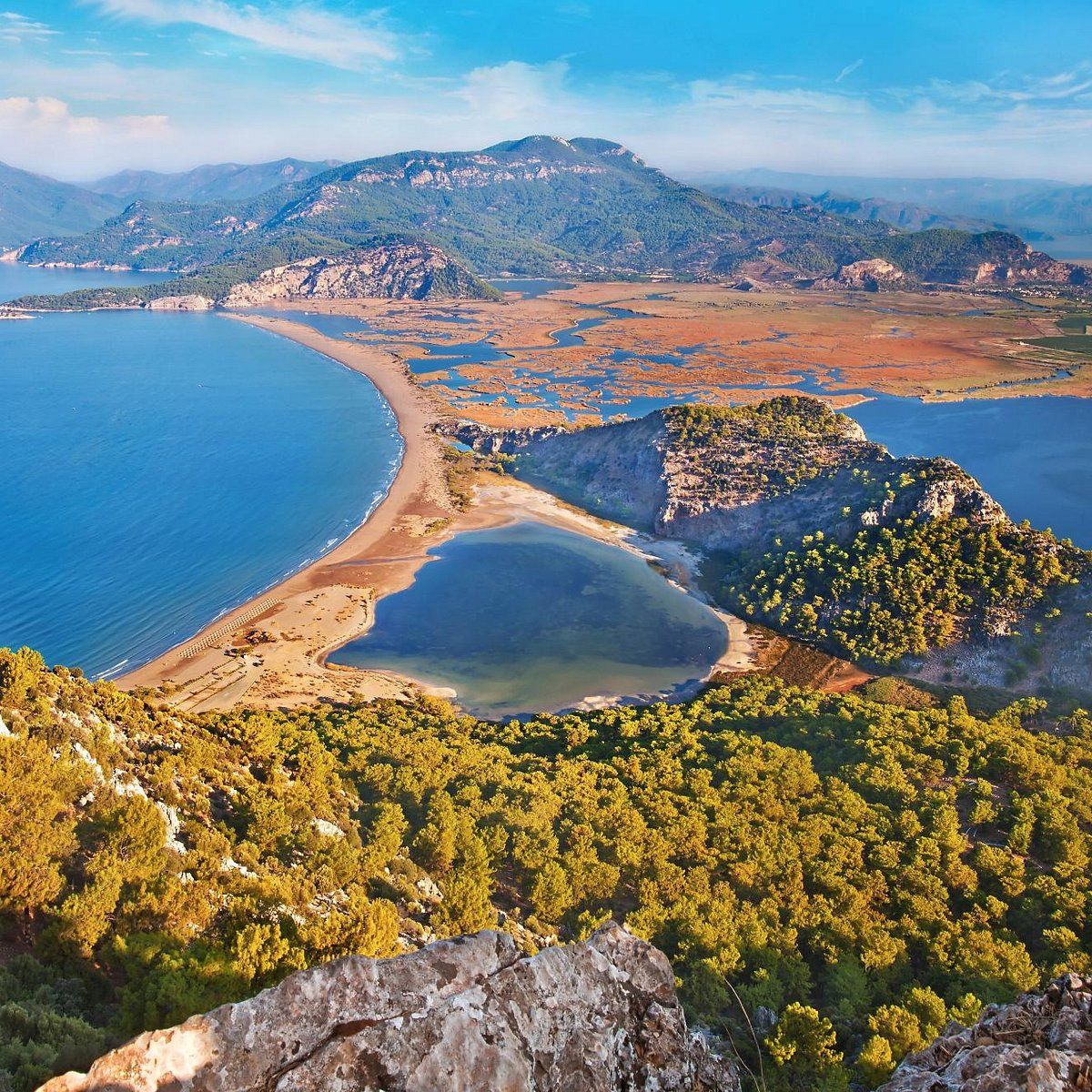
15 min drive from Dalyan center
Also known as Turtle Beach, this protected nesting ground for Caretta Caretta turtles offers a long stretch of sand where the river meets the sea. It serves as a natural contrast to the urban areas of Marmaris.
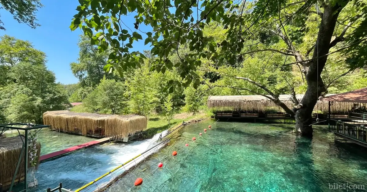
40 min drive from Dalyan
Located near Köyceğiz, this mountain stream area features restaurants built over the water. It provides a cooler environment for a meal break when traveling between the two main coastal hubs.
Everything you need to know about how far is dalyan from marmaris
The driving distance between Dalyan and Marmaris is approximately 90 kilometers via the D400 highway. Travelers typically find that the journey takes about 1.5 to 2 hours depending on traffic and transport mode.
When researching how far is dalyan from marmaris, visitors often look at the total kilometers along the coastline. This route connects the Mugla province landmarks through scenic winding roads.
Yes, the best arrival window is 08:00–10:00. Traveling during these morning hours helps you avoid the peak midday summer heat on the D400 highway.
There is an entrance fee of 0 TRY because this is a geographic distance between two cities rather than a ticketed attraction. No fees apply for the transit itself.
Traveling between these locations is straightforward for families, provided you plan for the drive time. Knowing how far is dalyan from marmaris allows you to prepare adequately for a comfortable road trip with children.
A common mistake is underestimating the effect of summer traffic on travel duration. Always check local conditions before departing to ensure your itinerary stays on schedule.